


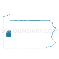
ZELIENOPLE VTD 01, Butler County, Pennsylvania
About
Outline

Summary
| Unique Area Identifier | 657972 |
| Name | ZELIENOPLE VTD 01 |
| County | Butler County |
| State | Pennsylvania |
| Area (square miles) | 0.43 |
| Land Area (square miles) | 0.43 |
| Water Area (square miles) | 0.00 |
| % of Land Area | 98.95 |
| % of Water Area | 1.05 |
| Latitude of the Internal Point | 40.78889250 |
| Longtitude of the Internal Point | -80.12947280 |
Maps


Graphs
Select a template below for downloading or customizing gragh for ZELIENOPLE VTD 01, Butler County, Pennsylvania


Neighbors
Neighoring Voting District (by Name) Neighboring Voting District on the Map
- HARMONY Voting District, Butler County, PA
- JACKSON TWP Voting District, Butler County, PA
- ZELIENOPLE VTD 02, Butler County, PA
- ZELIENOPLE VTD 03, Butler County, PA
Top 10 Neighboring County Subdivision (by Population) Neighboring County Subdivision on the Map
- Zelienople borough, Butler County, PA (3,812)
- Jackson township, Butler County, PA (3,657)
- Harmony borough, Butler County, PA (890)